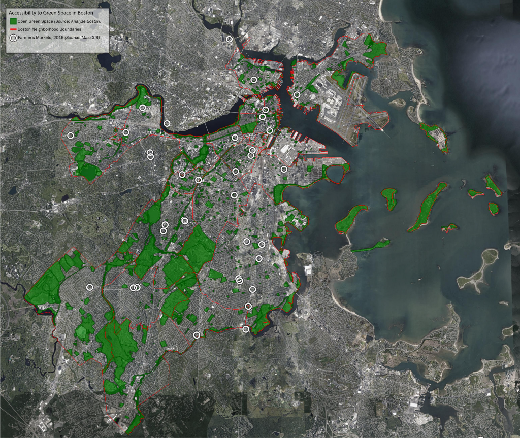
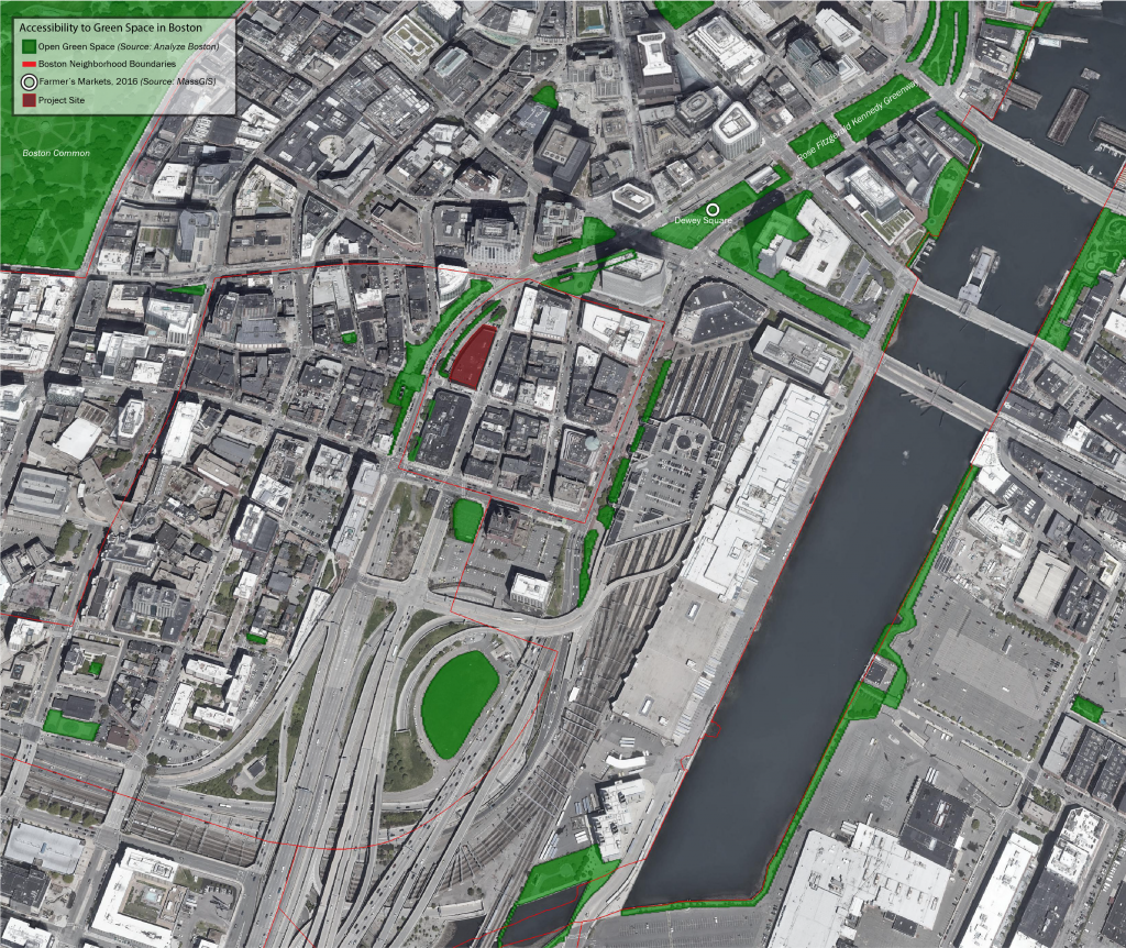
A study of the parks and other green spaces of Boston on a large scale, and those of the Chinatown neighborhood in greater detail, in order to incorporate the green libraryinto the existing fabric.
Created using Google Earth Pro and Adobe Illustrator.
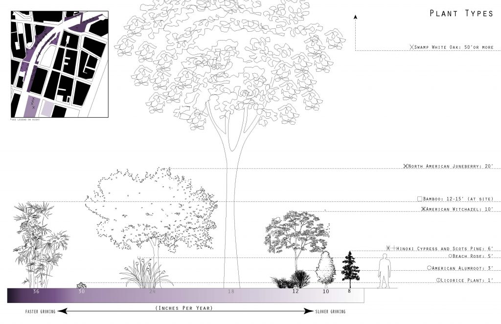
The site contains plants of various sizes, lifespans and growth rates, illustrated in the diagram on the left.