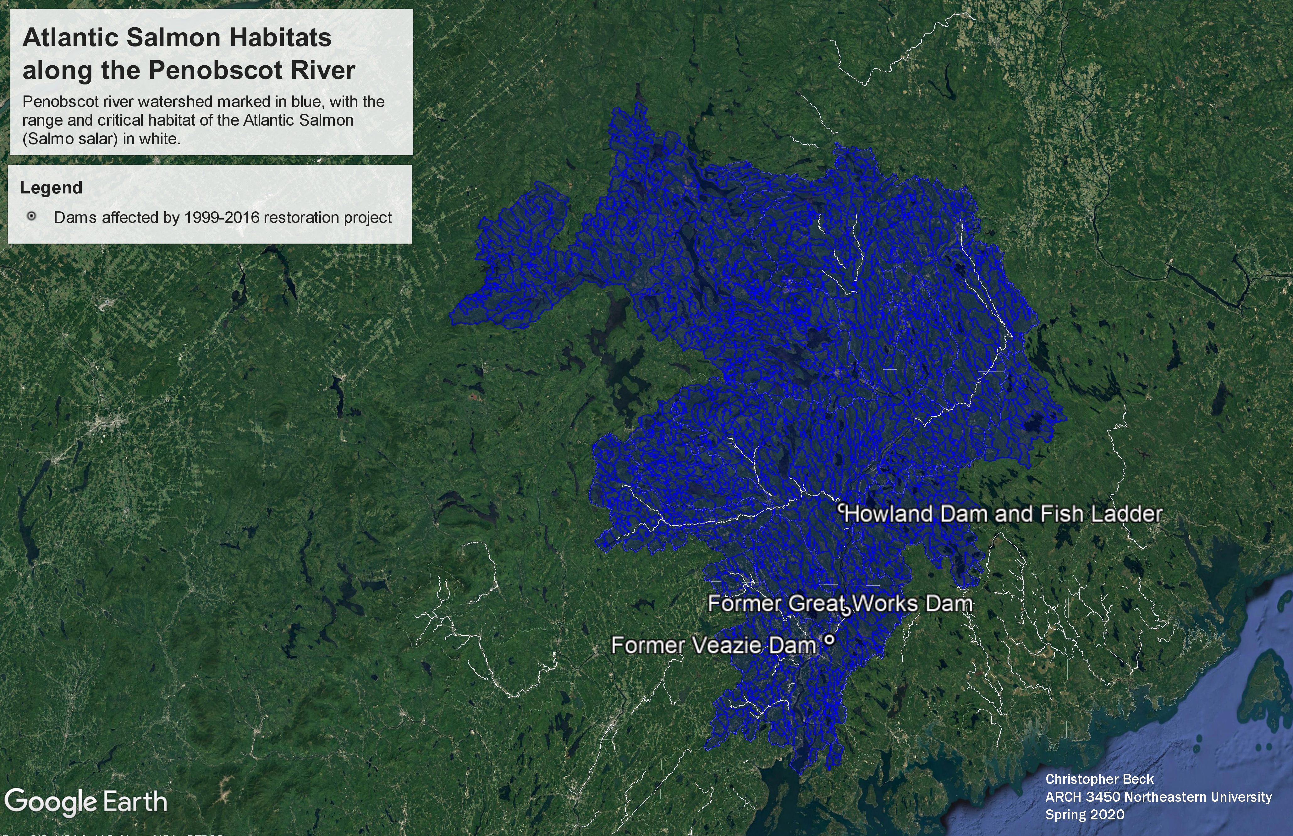
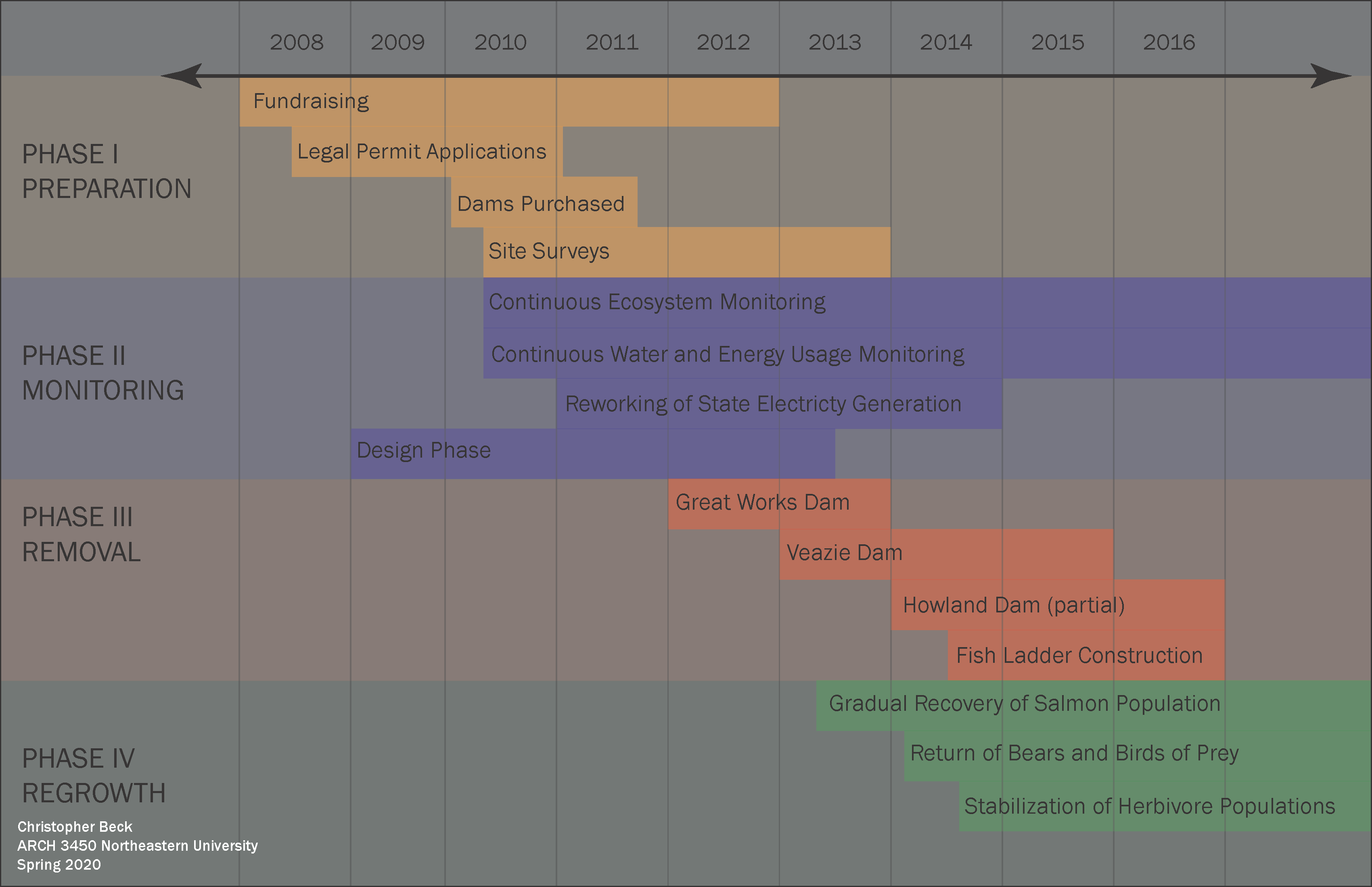
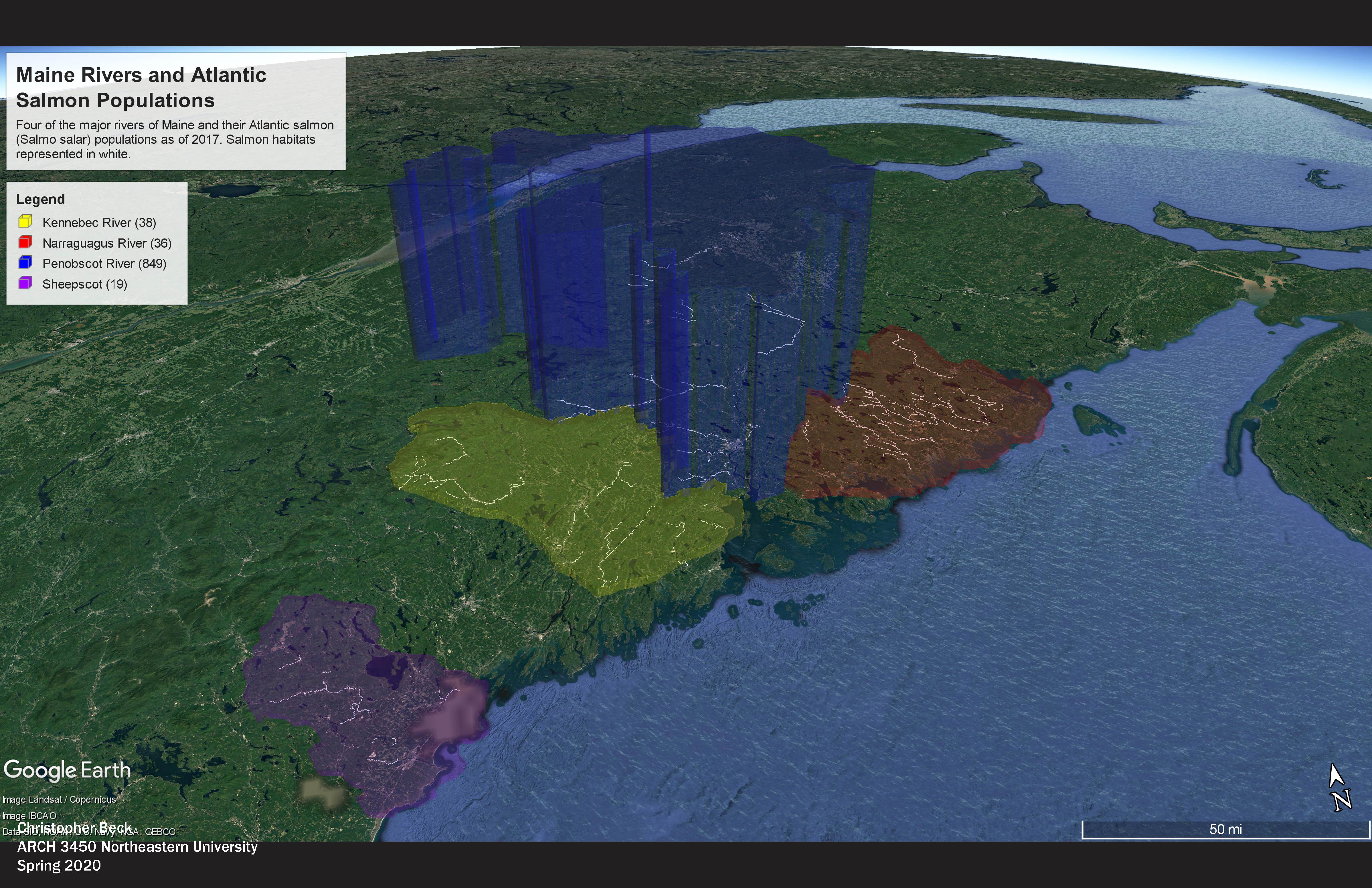
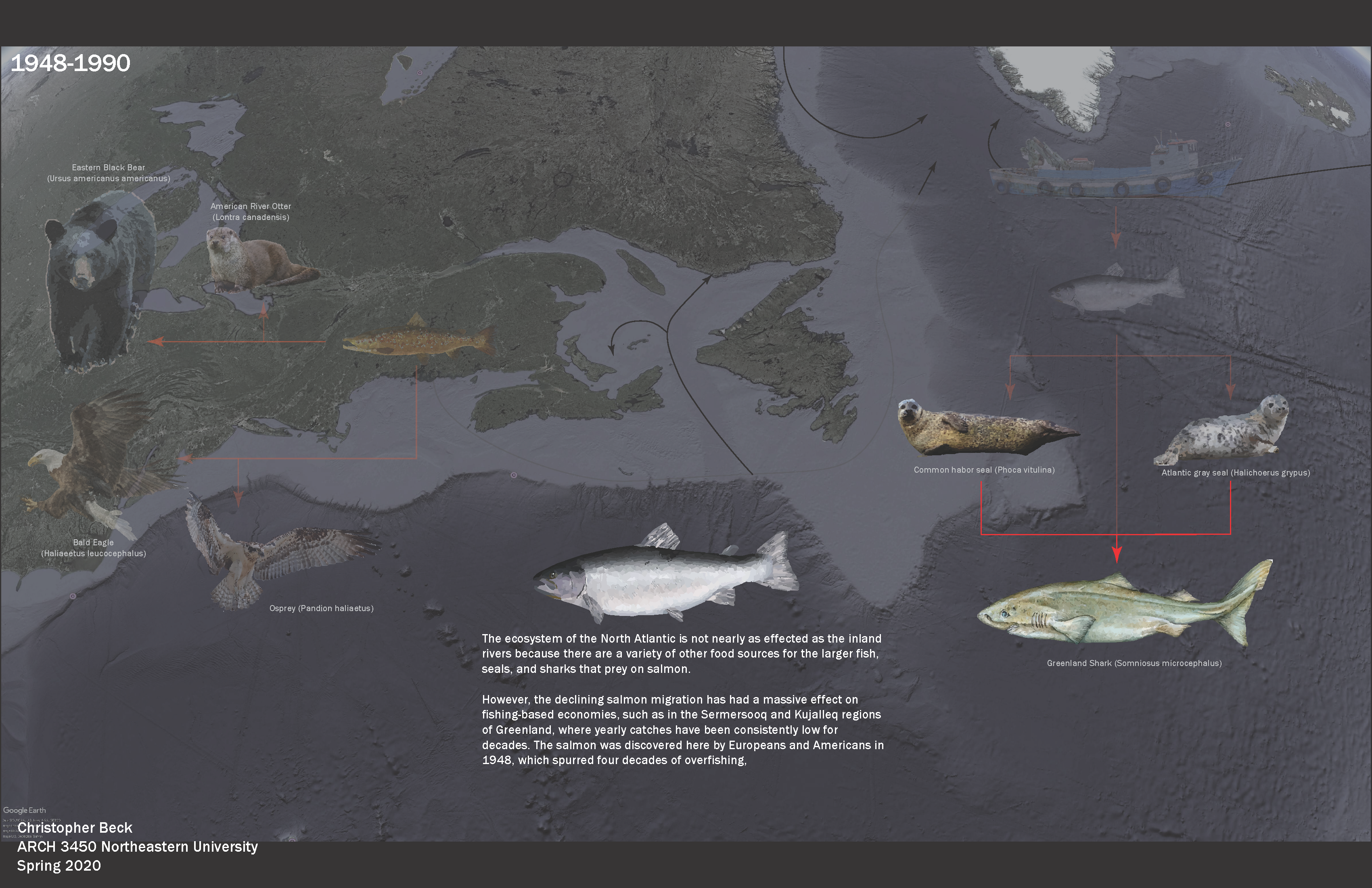
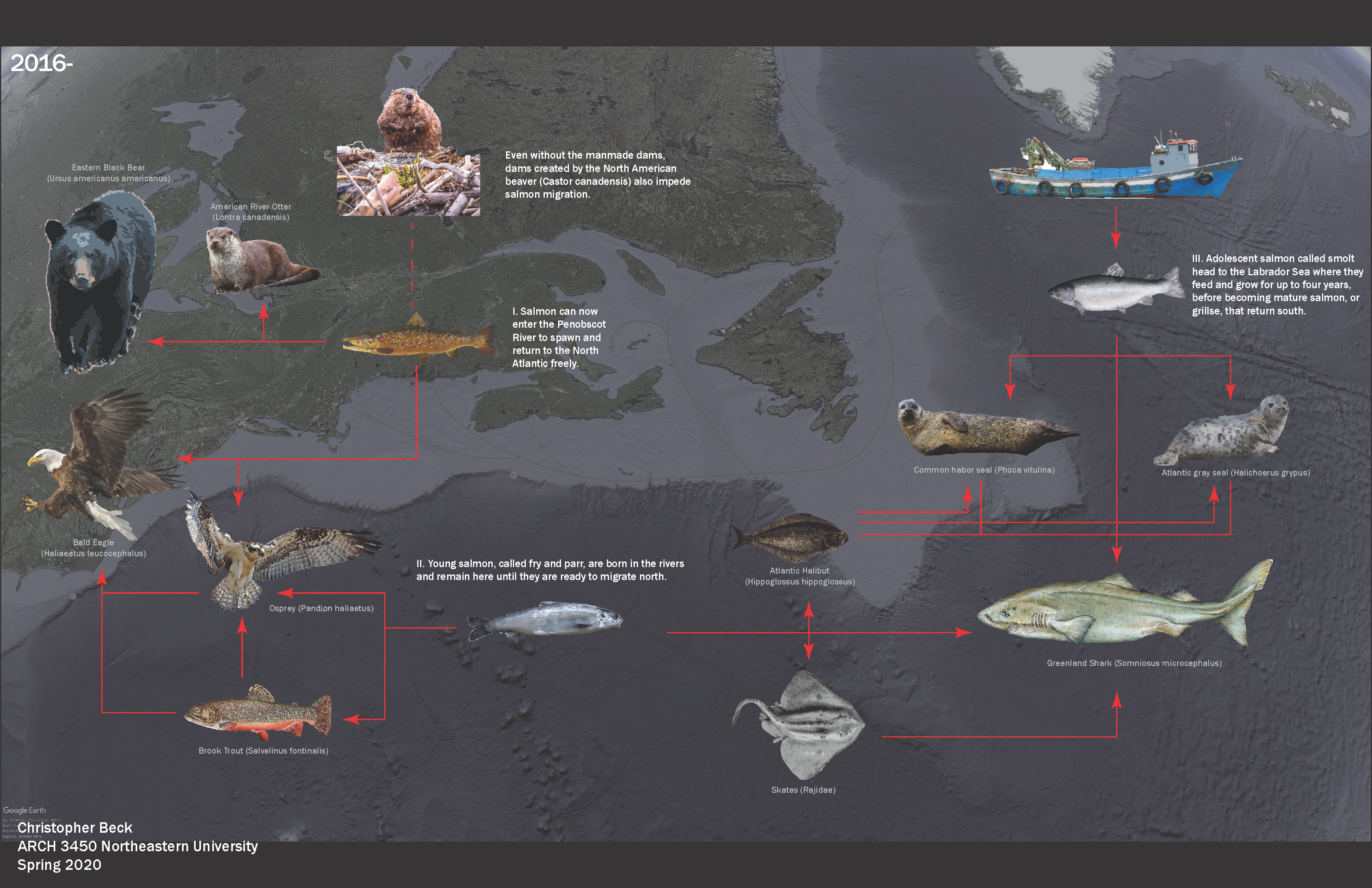
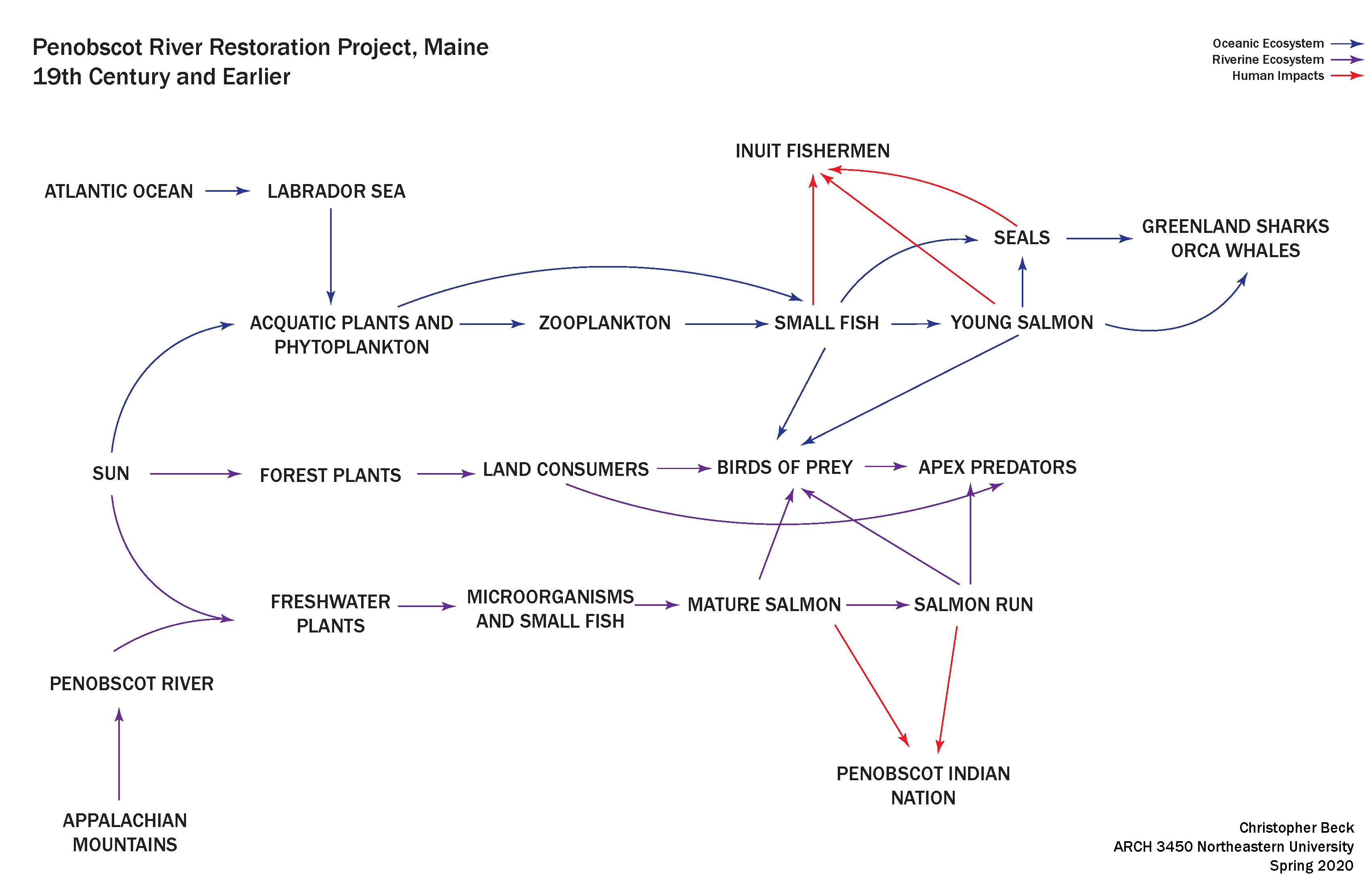
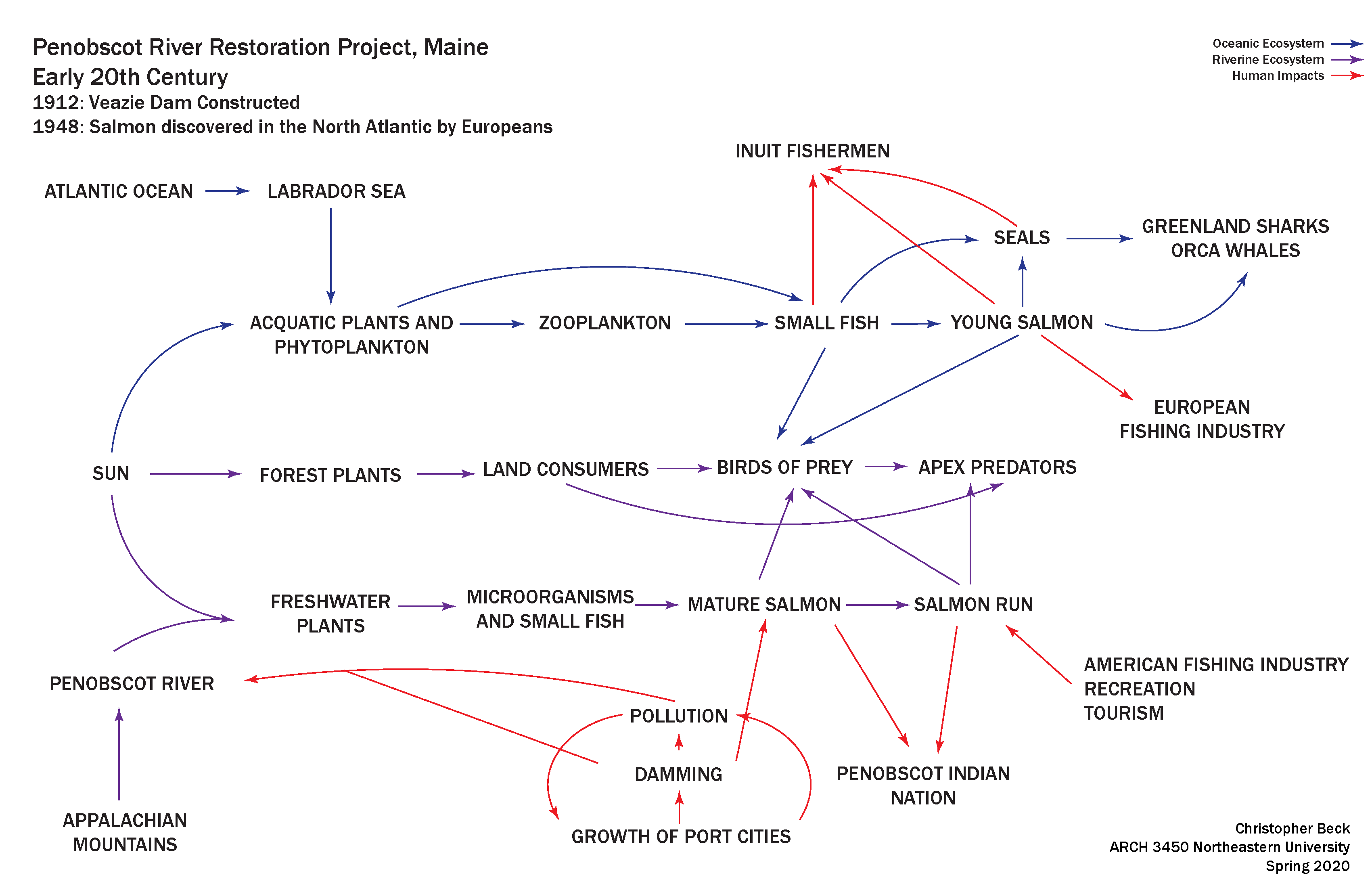
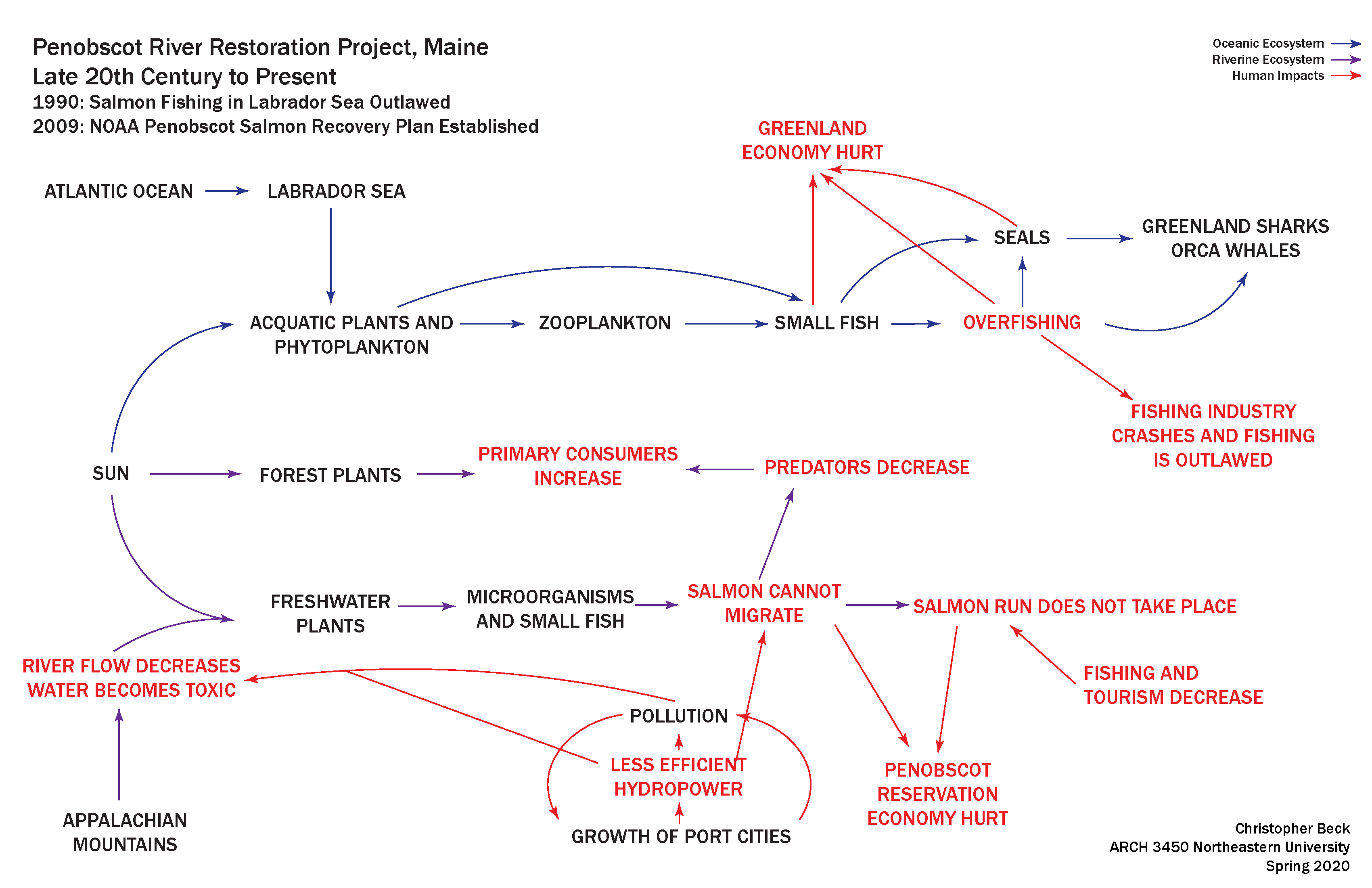
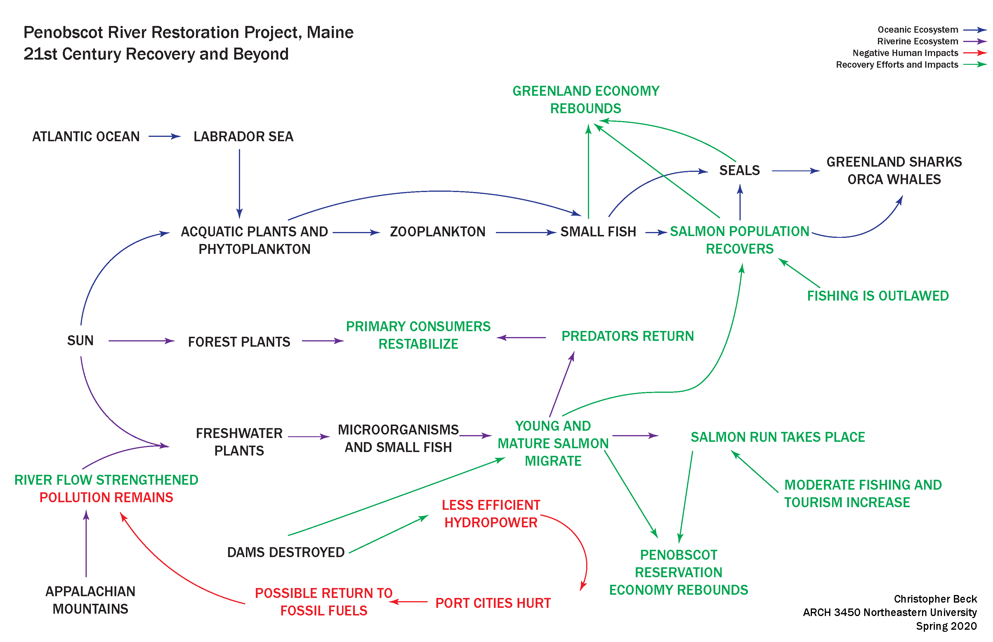
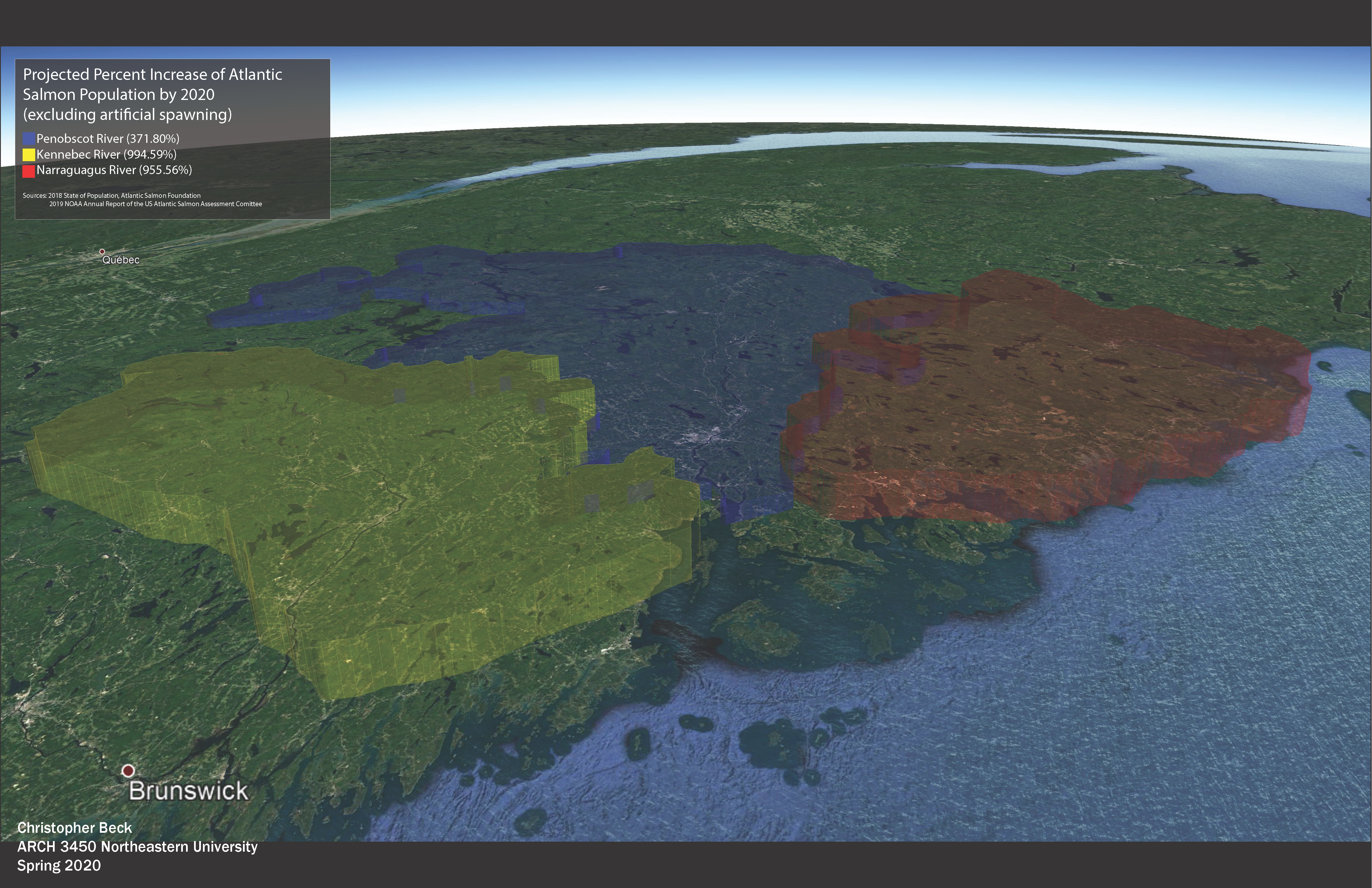
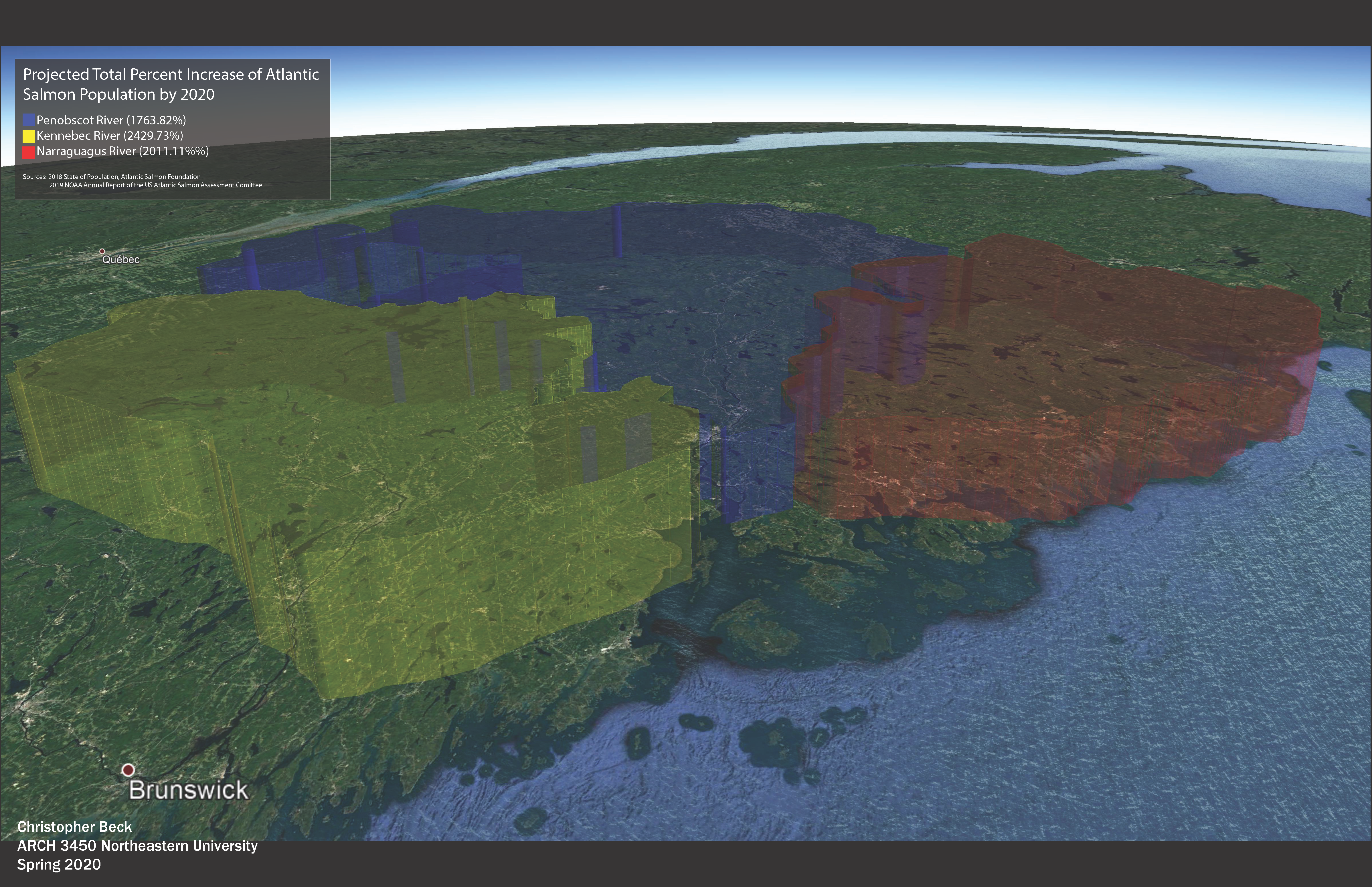
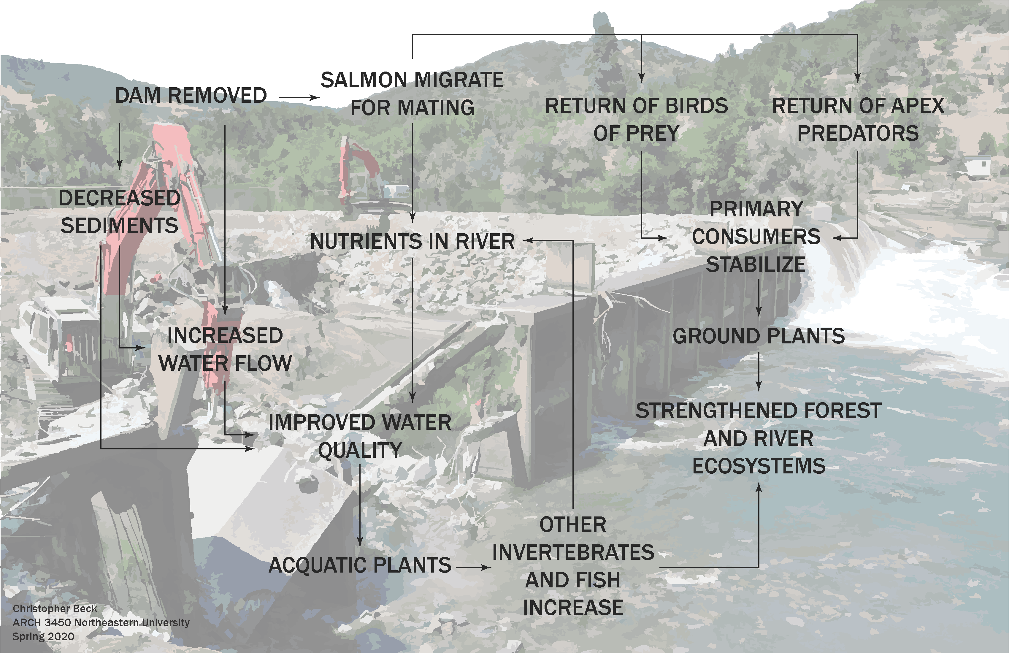
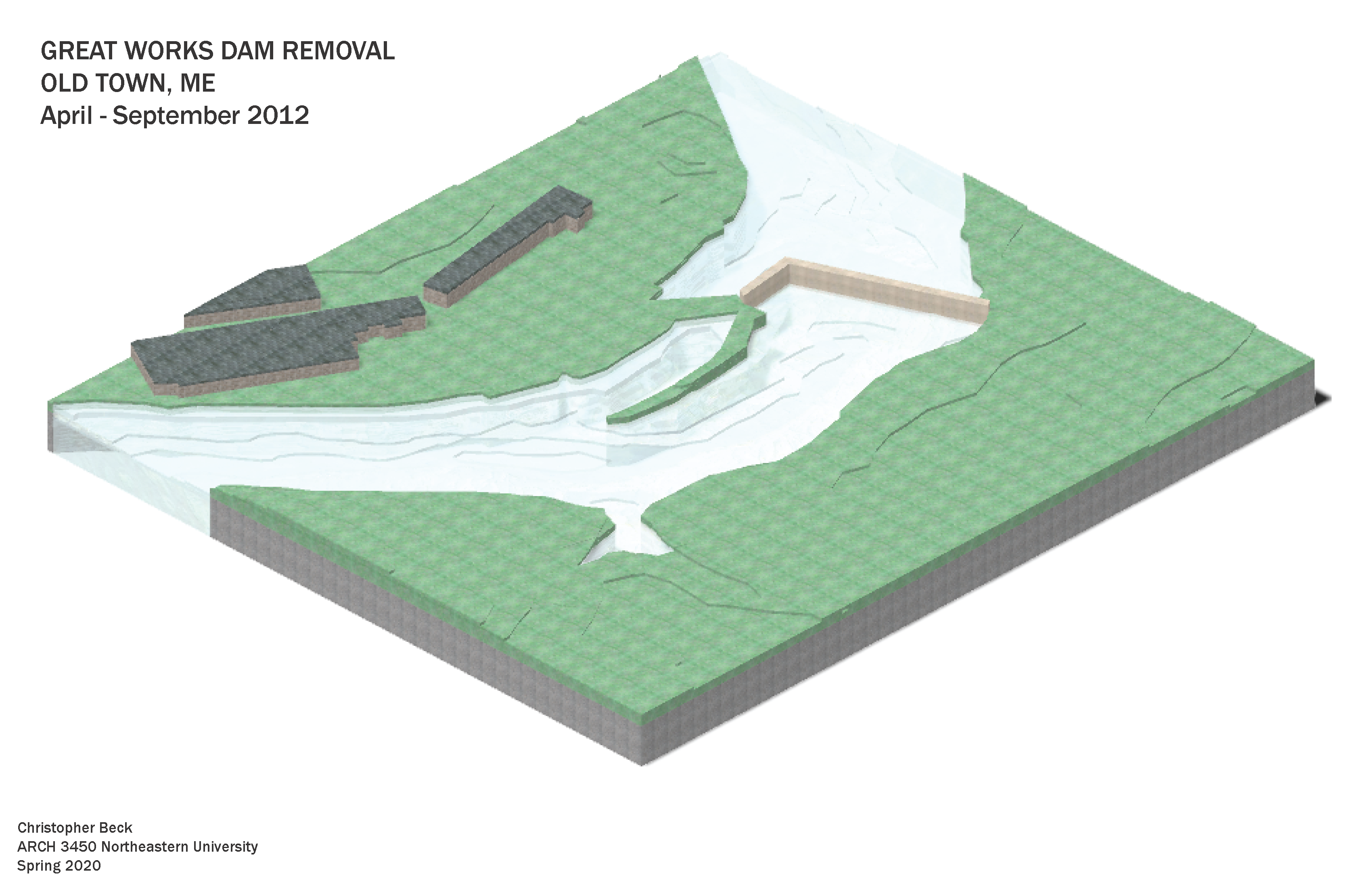
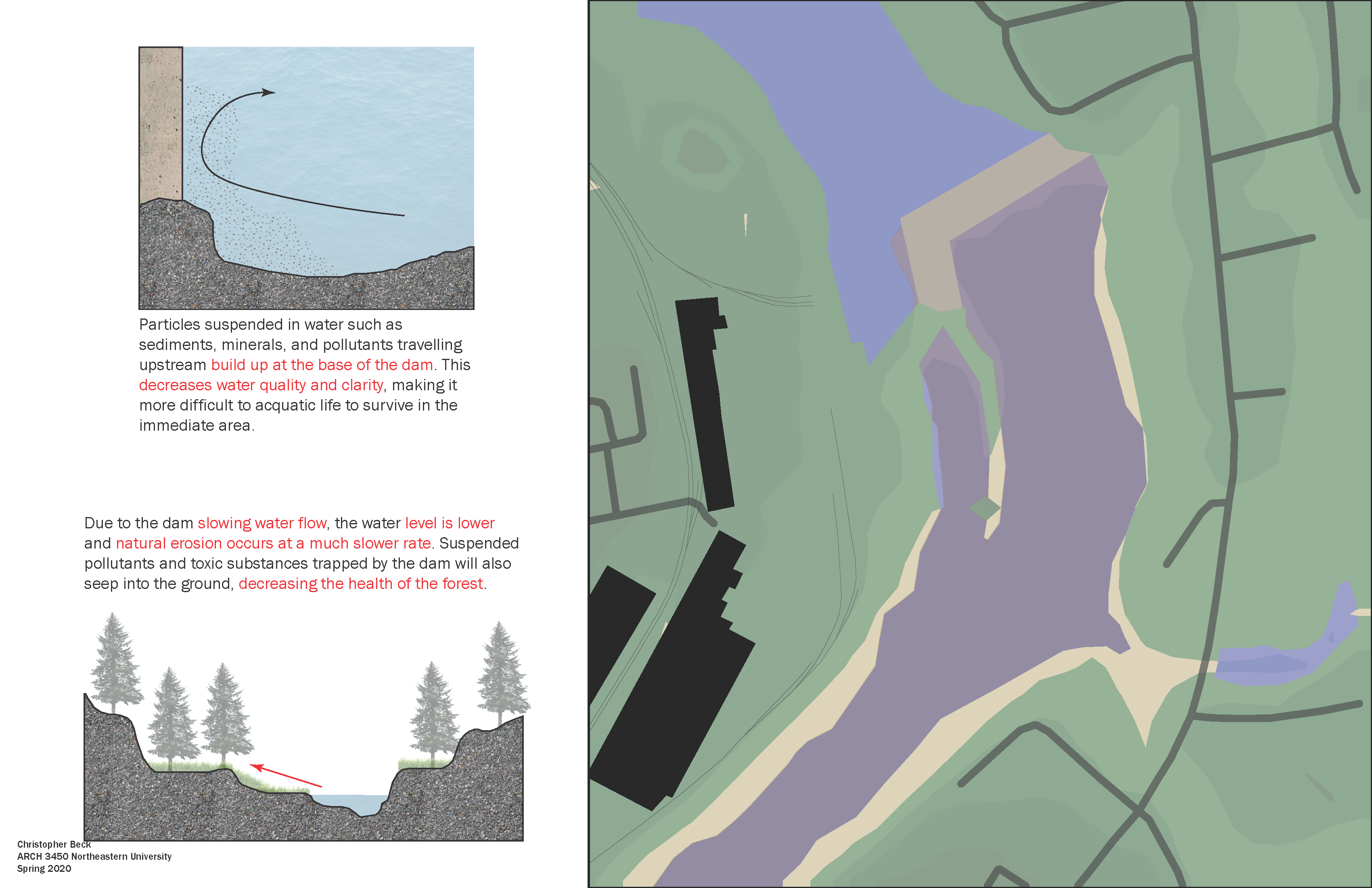
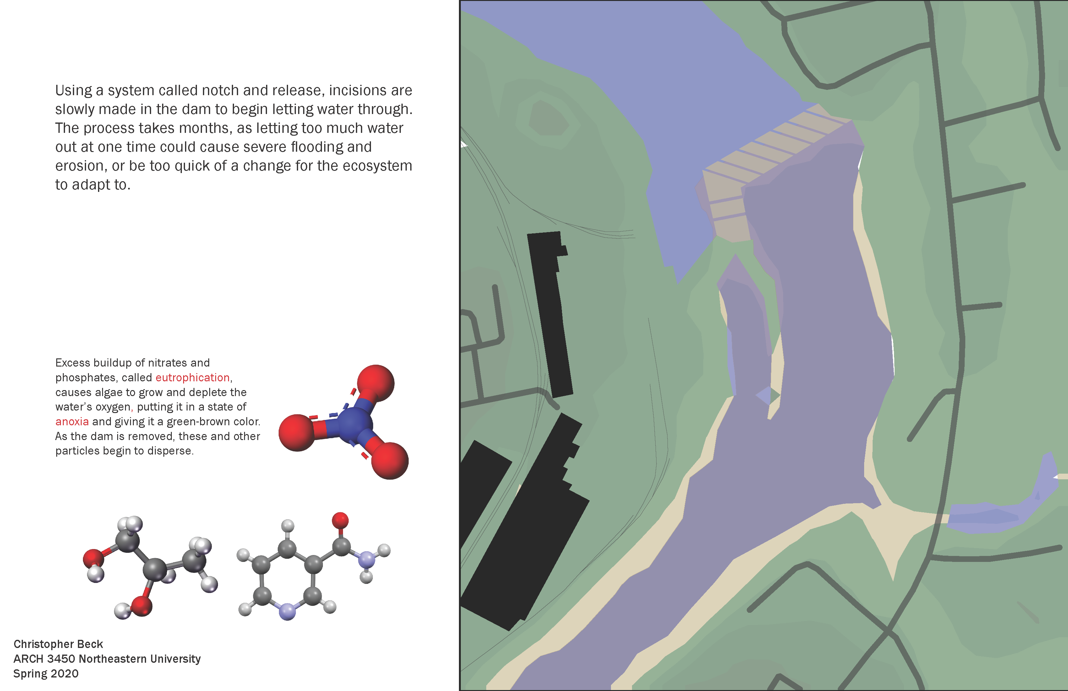
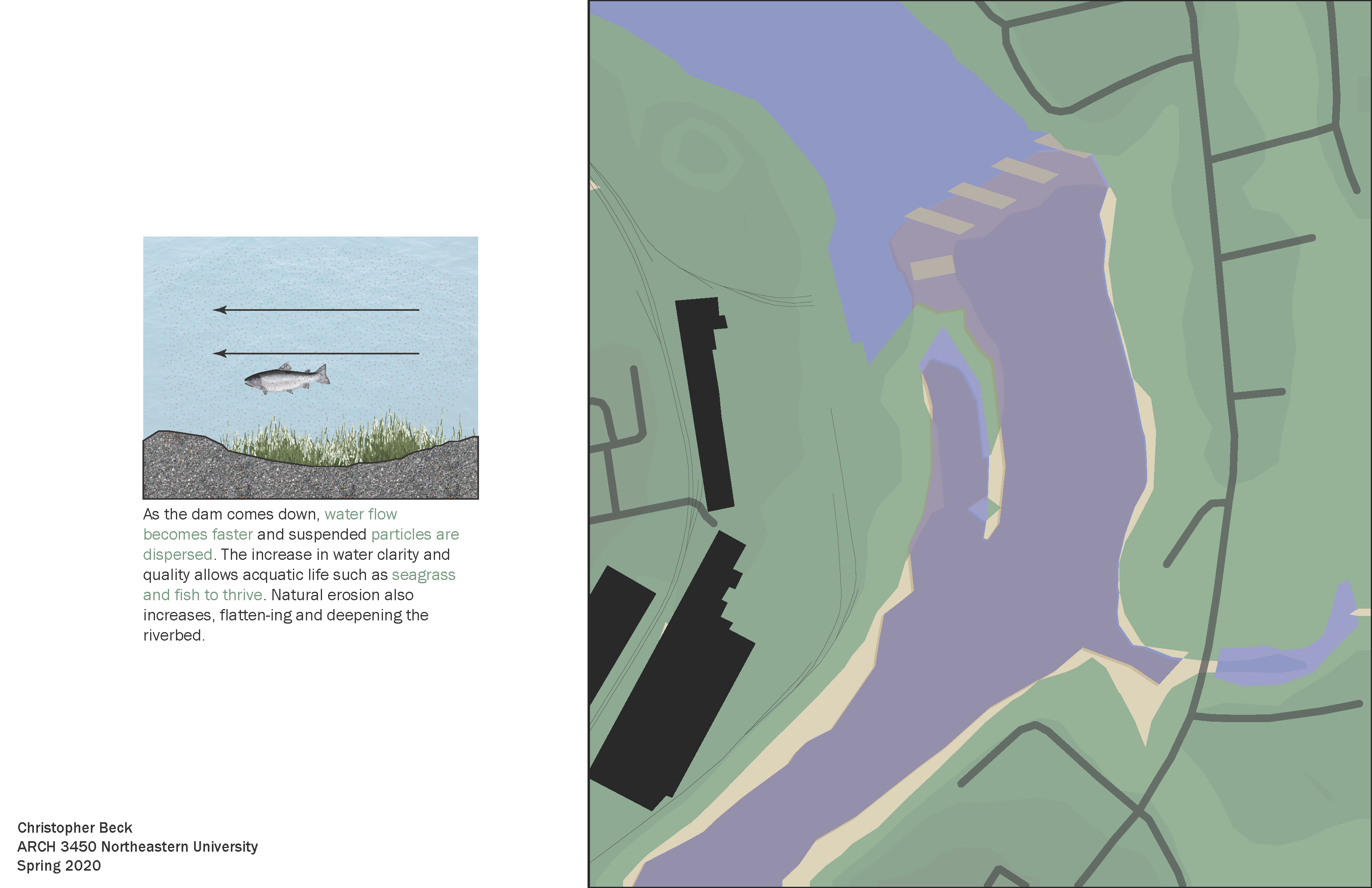
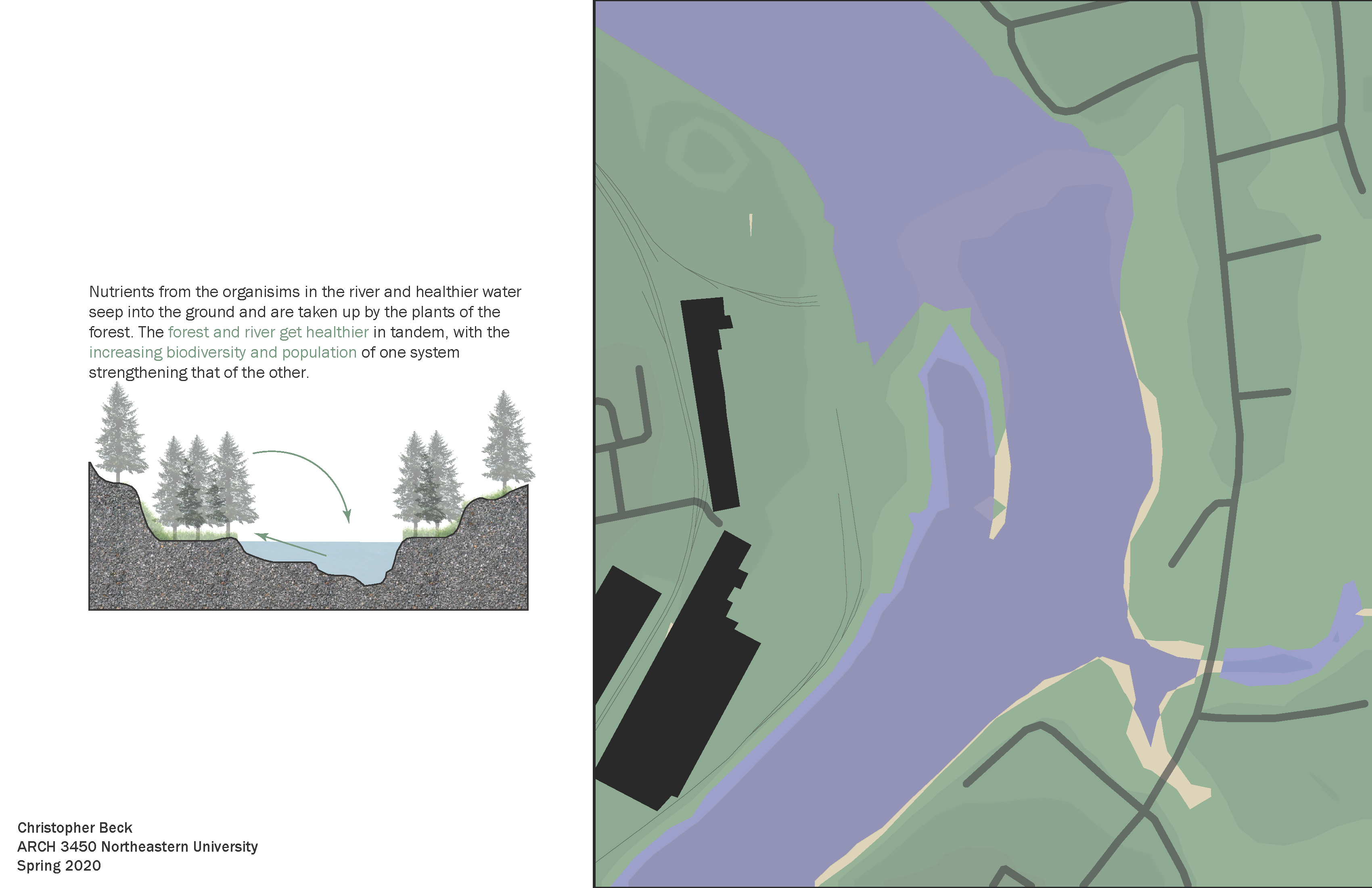
A series of diagrams about the history of the 1999-2016 restoration of the Penobscot River in Maine through the removal of two dams and construction of a fish ladder around the third. This project details the necessity for and process of dam removal, demonstrates the workings of the Penobscot ecosystem with and without the dam, and models future ecological and economic recovery of the area.
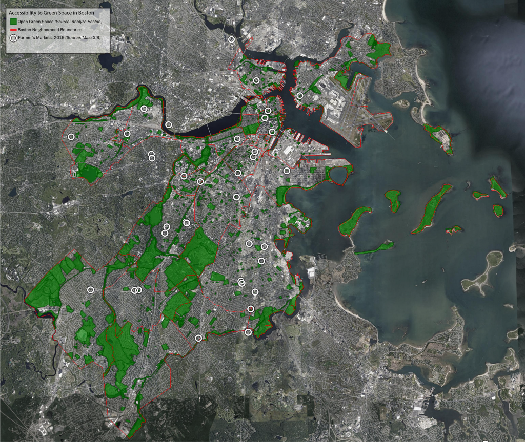
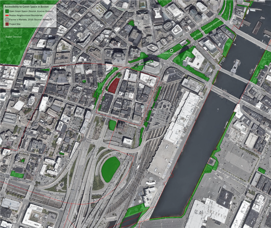
A study of the parks and other green spaces of Boston on a large scale, and those of the Chinatown neighborhood in greater detail, in order to incorporate the green libraryinto the existing fabric.
Created using Google Earth Pro and Adobe Illustrator.
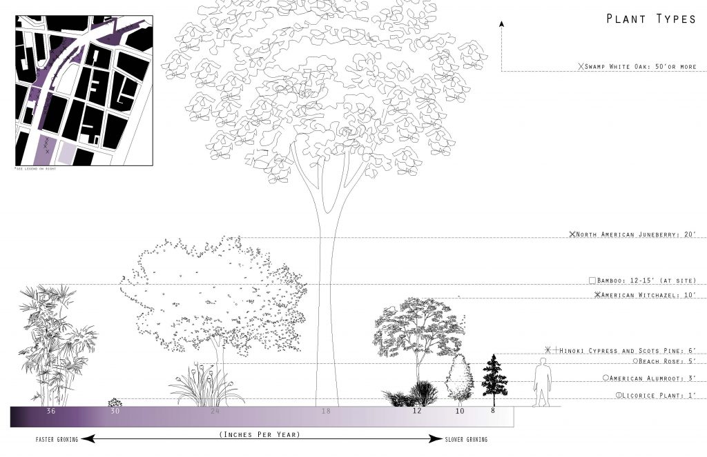
The site contains plants of various sizes, lifespans and growth rates, illustrated in the diagram on the left.